Konitsa is a mountainous town located at the northernmost point of N. Ioannina. It borders to the east with W. Macedonia (N. Kastoria and N. Grevena) and to the west with Albania. It is a city with rich historical and cultural history, which is why tourism in the region is constantly increasing.
Konitsa is 64km from Ioannina, and 40 minutes from the Airport. The distance from Athens is 550 km and from Thessaloniki 350 km. The connection with Macedonia and Thessalonica is via the national highway Ioannina – Kozani, which meets the Egnatia road at the height of Neapolis.
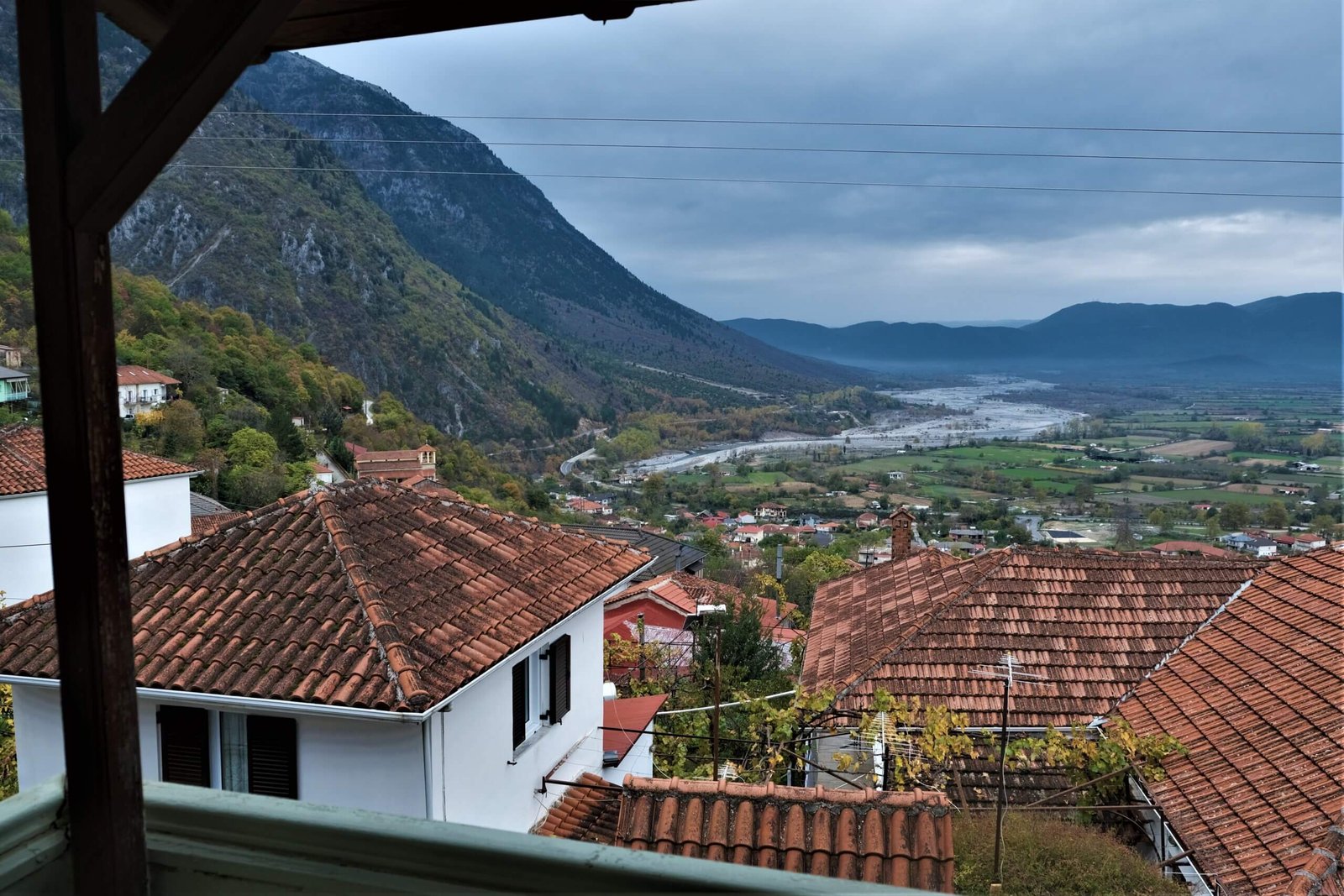
Built amphitheatrically on Gimnadi mountain, it overlooks the fertile plain watered by three famous rivers: Aoos, Voidomatis and Sarantaporos. Its symbol is a unique creation of the stone master Zioga Fronzo. It is a traditional bridge that emerges just before the visitor enters the small town. In addition, it is one of the largest single arched stone bridges in the Balkans and represents a masterpiece of the time it was built (1823-1871).
No one has realized how close Drakolimni Smolika Konitsa is to the famous Zagorochoria and how different and revealing the perspective of the area is from there. Konitsa can be considered as one of the centers of Epirus regarding “extreme” activities such as kayaking, rafting, paragliding, etc. It has beauties that are carefully hidden and are waiting for the visitor to discover them.
Perhaps it may sound excessive but Haradra Aou Konitsa focuses the interest of all those who seek adventure. The area is gifted and offers many options for beginners as well as experienced adventure hunters. The first and easiest activity one can do is to simply go for a walk. Two of the most interesting routes are right next to the two rivers. As the visitor follows the route that is opposite to the flow of the Aoos river, after about 1.5 hours he arrives at the Stomio Monastery. The view from that point takes your breath away.
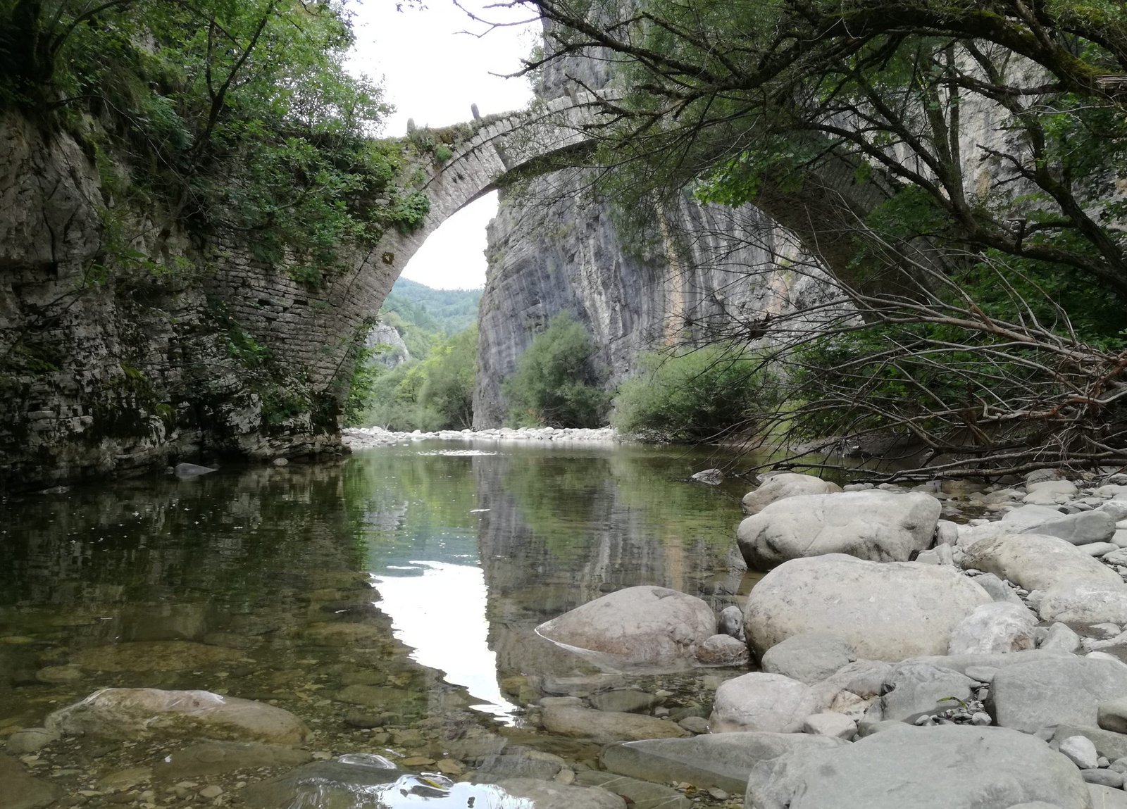
The other route in Voidomatis is easier Aoowalla Bridge and more exciting as it starts from the stone bridge of Klidonia and ends at the monastery of Panagia Spiliotissa, on the road that joins Aristi and Papigo. The same route can be followed in reverse with the help of an inflatable boat.
Aoos caters to those who are well versed in kayaking as it is considered one of the most difficult routes. Voidomati Bridge For this reason, experienced kayakers from all over the world gather in its foamy waters. One of the best slopes for mountain parachutes (parapente) is located just above Konitsa on the hill of Prophet Ilias. It is a common phenomenon that the sky of Konitsa is full of many colorful floating dots, when of course the weather allows it. In addition, it should not be overlooked that in the same area there are many excellent routes for mountain bikes and mountaineering.
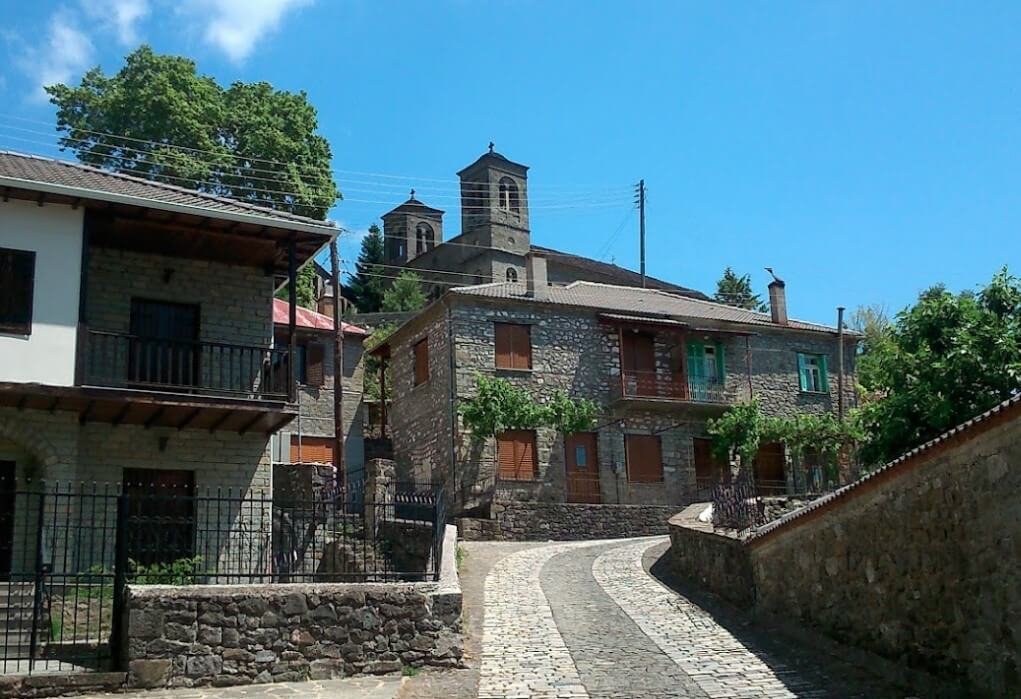
Konitsa, amphitheatrically built in the hand of the Prophet Ilias, follows the Epirotian stone architecture. As the visitor climbs Ano Konitsa, he can admire the imposing stone houses that were built during the Turkish occupation. One of the “jewels” of Konitsa is the house of Hamkos, Ali Pasha’s mother. The church of Agios Kosmas of Etolos is located a few meters away from the center of the small town. Next to the church is the statue of Metropolitan Sevastianos (+1994).
Zagori is a region in the prefecture of Ioannina, in northwestern Greece. In the area there are 45 villages, the so-called Zagorochoria, which are scattered at the foot of Pindos. It has an area of about 1,000 square kilometers and starts from the South Western part from Mt. Mitsikeli (altitude 1,810m), reaches north to the Aoos River and Mount Tymfi and east to the Varda River in Mavrovouni (altitude 2,100m) near Metsovo.
Mastorohoria extends in the northern part of the Prefecture of Ioannina and occupies an area of 271,160 acres, which represents approximately 5% of the total land area of the Prefecture of Ioannina and 35% of the wider region of Konitsa. Built on the right and left of the Saradaporos river, they reach the outskirts of Grammos, on the Greek-Albanian border.
The combination of the diversity of the relief, the special geological formations, of the Sarantaporos river with the branches of Vourbianitiko, Pistiliapi and Loupsiotiko (Divoika – Lygeri) creates very interesting natural landscapes with limited human presence. Many interesting landscapes and historical architectural elements for the visitor. Exploring the microscapes in the forests, the subalpine zone and the rivers, the search for old abandoned or destroyed villages always give information about the nature, the history of the area and unforgettable experiences for the visitor.
Stone houses, a square of unique beauty with a fountain (1903) on the foundations of the community office, the church of Agia Paraskevi (1930) and the stone-built school (1927) are notable examples of the local architectural tradition. The picture is completed by the old chapel of Agios Athanasios at the edges of the upper mahala and the Dormition of the Virgin Mary (1902) at the entrance of the village. These are exceptional constructions with hagiographic decoration.
The section Pano and Kato Arenes and the adjacent Bukhetsi (impressive mountain masses with vertical vertical slopes that stand out above mature beech forests) – Moutsala Lake and Triakosara Fountain. This area is already a magnet for a large number of visitors. Of special interest are the abandoned settlements of Theotokou, Zermas of Lykorachi and Pistiliapi.
The alpine landscape, bare of tree vegetation, is one of the only ones in such a large area in our country. The relief is quite complex, sometimes with gentle and sometimes with steep slopes, dotted with wild flowers and running water in rock formations. The crossing of the mountain from Aetomilitsa or Plikati to the village of Grammos, the route to the alpine lake of Grammos and the summit as well as the ascent from Kefalochori to the old Lykorachi and the Arenas are the most interesting routes for climbers and hikers. The view from many peaks is impressive.
Mountains and locations known from the civil war period and the neighborhood with the steam baths of Amaranto (Isvoros). Forested on the edges with conifers and deciduous trees, with a great variety of flora, which creates an unrepeatable diversity of colors and forms in the landscape.
Impressive mountain with steep rock formations that descend to the Sarandaporos River. The alternation between black pine and beech as well as the wide view towards the surrounding peaks and the neighboring and always snow-covered Smoliga give an unrepeatable picture.
Aoos is a river of Epirus with a total length of 260 km. Of these, 70 km are in Greek territory and the remaining 190 km in Albanian territory. The Aoos river, due to the beauty of the landscape that surrounds it, has contributed significantly to the tourism development of the area. Stomio Monastery is built inside the ravine, while at its exit is the bridge of Konitsa. The river is 1.5km from Dentro Guest House.
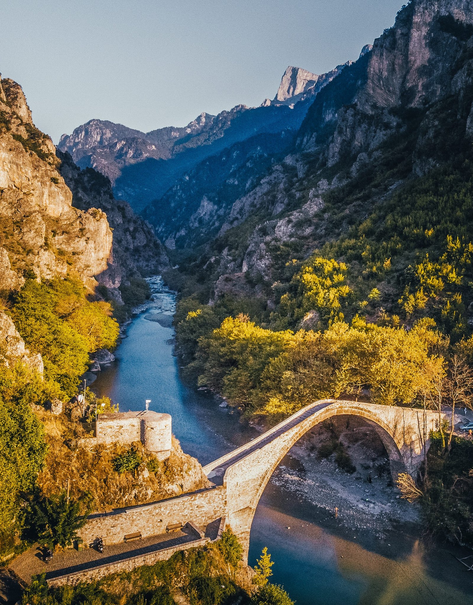
The Bridge of Konitsa was built in 1869 and is located on the southwestern edge of the city, right at the entrance to the ravine of the Aoos River, which it bridges. It is a single-arched stone-built bridge that stands out for its huge arch. Our guest house is 1.5 km away on foot from the bridge, and is a point of interest for every visitor to the area.

The Tree Church of Agios Paisios is a small church inside a tree, and it ranks third among the attractions of Konitsa according to the TripAdvisor world guide. The distance from our guesthouse is 22 kilometers.
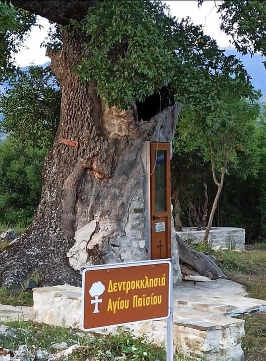
In the ravine of Aoos, is the Monastery of Panagia Stomio. It is a reference point for Konitsa. Its location and the route of about an hour on foot, is captivating.

The thermal baths of Kavasilo are 11km from the guest house, and have a suitable infrastructure for spa treatments.
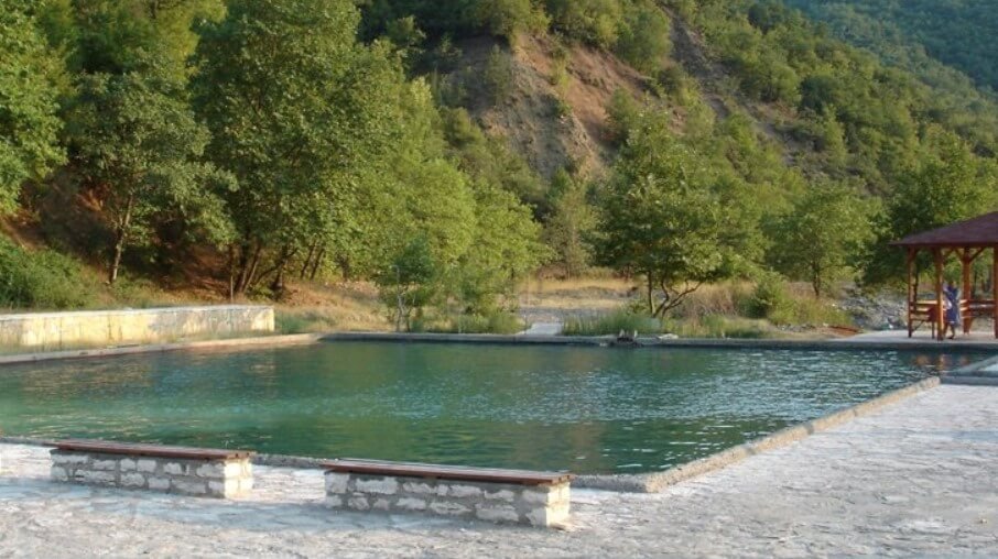
The Amaranto Baths work with the natural use of hot air that is channeled from the inside of the earth, making them the only Baths of their kind in Europe. From the guesthouse, they are only 19km away.
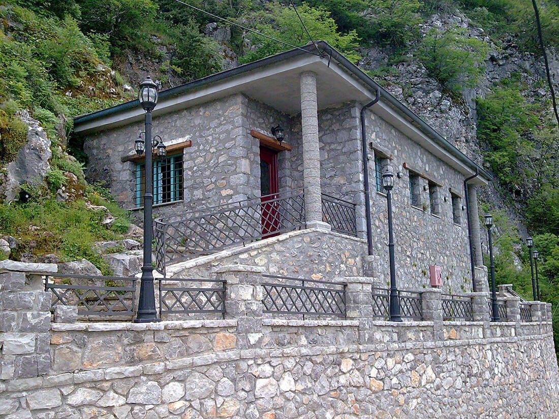


The Amaranto Baths work with the natural use of hot air that is channeled from the inside of the earth, making them the only Baths of their kind in Europe. From the guesthouse, they are only 19km away.

